Date
March 30 1989
Map Layers
Media Type
Container
Author
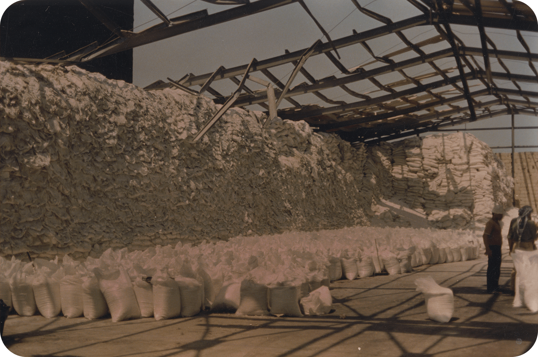
Image taken by Dr. Pierre Malychef documenting the 1989 Dora Port Explosion and its aftermaths on March 30th 1989. For more information on the explosion, please go to: https://dark.society.systems/contribution/a-history-of-ammonia/ The photograph shows workers in a destitute hangar with a pressure-torn roof post-explosion. Similarly to Hangar 12, the hangar is filled with white sacks, akin to the ammonium nitrate sacks we all became familiar with in the last 3 years. A huge number of the sacks in the upper left part of the image are molten, due to the heat of the explosion.